Pets allowed
Not Allowed
Elevation Gain
3,543.00 ft (1,079.91 m)
Trail type
There-and-back
Distance
4.80 mi (7.72 km)
Please respect the outdoors by practicing Leave No Trace. Learn more about how to apply the principles of Leave No Trace on your next outdoor adventure here.

Despite it’s relatively short trail mileage of 4.8 miles round trip, Noonmark is a very challenging hike that gets steeper as it approaches the summit at 3,556 feet. It also provides unparalleled views of the Great Range along with excellent views of Giant Mountain and Keene Valley.

Hikers will begin at the St. Huberts Parking area, following the paved road for 0.25 miles to the Noonmark Trail Way road. Turn left there, following until the trail begins at 0.2 miles on the right. While the trail begins climbing gradually, it quickly establishes a series of waves of intensity, climbing steeply before leveling off, and climbing steeply again.

After one particularly steep stretch, hikers will reach the first of several outcroppings that provide views to the all too distant summit as well as several of the surrounding High Peaks. From here, bedrock slabs begin making up much of the trail as it climbs very steeply up toward the summit.

At the top, incredible views of the Great Range to the west, Giant to the east, and several other High Peaks reward your effort. There is just enough foliage at the summit to offer some seclusion, but the difficulty of this hike often keeps crowds at bay. Return the way you climbed, or add a few miles and another peak (Round Mountain) for a loop back to the car.

Logistics + Planning

Current Weather: Powered by Dark Sky

Rain throughout the day.
Wed
66°F
57°
Possible light rain in the morning.
Thu
69°F
56°
Partly cloudy throughout the day.
Fri
74°F
54°
Partly cloudy throughout the day.
Sat
78°F
55°
Mostly cloudy throughout the day.
Sun
78°F
55°
Mostly cloudy throughout the day.
Mon
79°F
55°
Partly cloudy throughout the day.
Tue
77°F
57°

Preferable season(s)

Spring
Summer
Fall

Congestion

Low

Parking Pass

Not Required

Pros

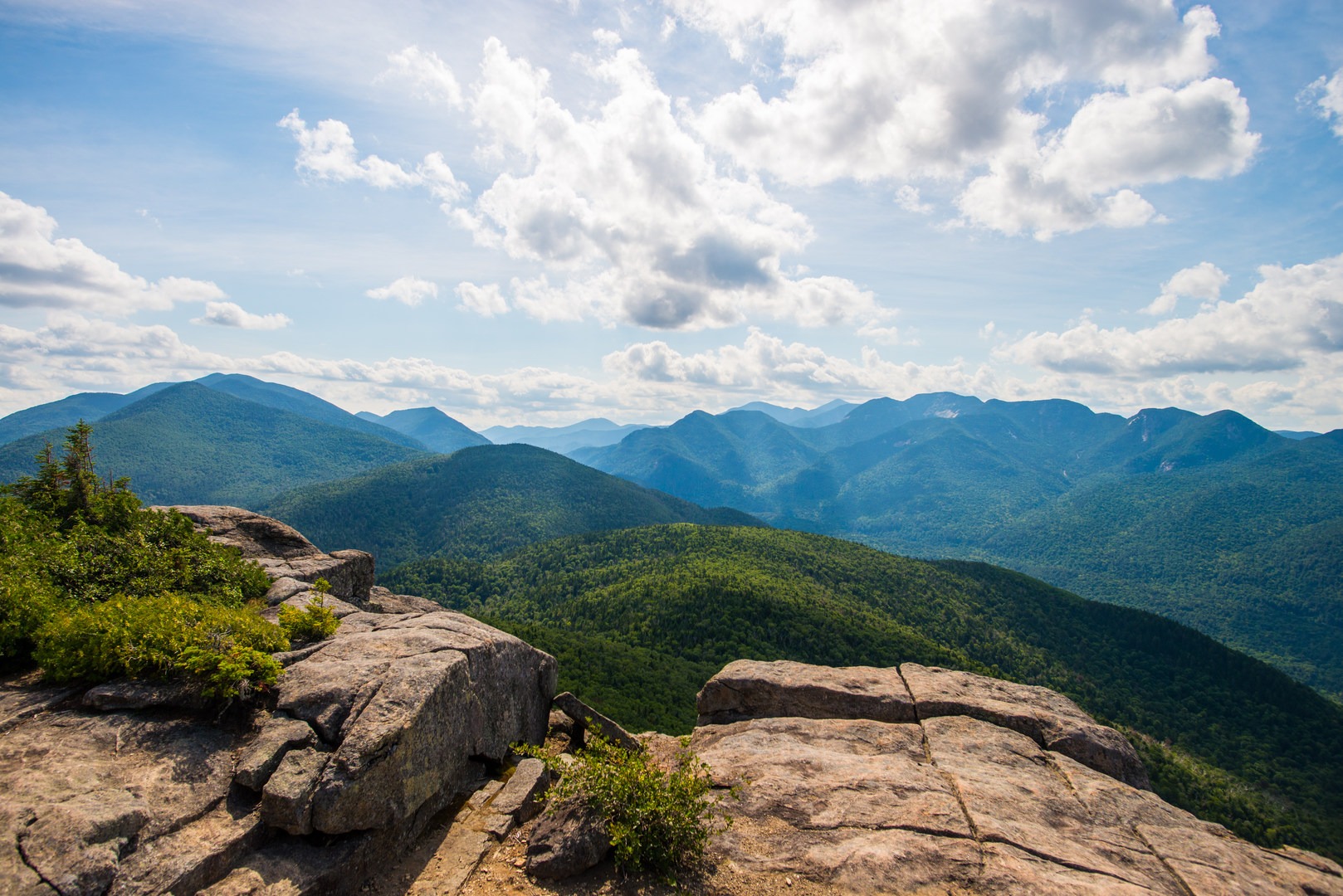
Beautiful views. Less crowded than other peaks.

Cons

Very steep.

Trailhead Elevation

1,165.00 ft (355.09 m)

Features

Bird watching
Wildlife
Big vistas
Old-growth forest

Location

Comments

Have updates, photos, alerts, or just want to leave a comment?
Sign In and share them.