
You are here
Sponsored by:
Pets allowed
Allowed
Elevation Gain
2,301.00 ft (701.34 m)
Trail type
There-and-back
Distance
9.80 mi (15.77 km)
Please respect the outdoors by practicing Leave No Trace. Learn more about how to apply the principles of Leave No Trace on your next outdoor adventure here.
Logistics + Planning
Current Weather: Powered by Dark Sky

Tue
63°F
39°

Wed
50°F
29°

Thu
50°F
26°

Fri
55°F
30°

Sat
64°F
30°
Sun
65°F
30°
Mon
70°F
36°
Preferable season(s)
Summer
Fall
Congestion
Moderate
Parking Pass
Not Required
Pros
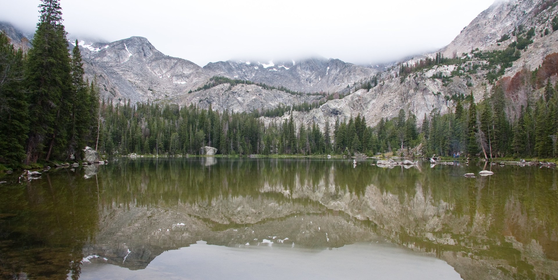
Beautiful alpine cirque. Potential climbing. Mid-summer wildflower meadows.
Cons
No bridge over Fall Creek to acces the trail. Mosquitos. Can be crowded on weekends.
Trailhead Elevation
7,240.00 ft (2,206.75 m)
Features
Backcountry camping
Mountaineering
Rock climbing
Waterfalls
Big vistas
Wildflowers
Fishing
Suitable for
Horseback
Location


Brought to you by:
Our mission is to inspire adventure with beautiful, comprehensive and waterproof map-based guidebooks. Owner, publisher, and photographer Matt Leidecker, grew up exploring and guiding on the rivers in central Idaho. His award winning Middle Fork of the Salmon River – A Comprehensive Guide is the standard by which other river guidebooks are measured. Printed on virtually indestructible YUPO paper, IRP guides are truly unique all-in-one resources for adventure. Each book is loaded with full-color maps, stunning photographs, and information on the history, geology, and wildflowers. Visit Idaho River Publications to explore our guidebooks to the Rogue River in Oregon and the mountains of Central Idaho.
More content from Idaho River Publications


Comments
After the first creek crossing the sign to Moose Lake was missing but someone had carved it into the post. My GPS said 5.45 miles from the trail head to the lake with 2200 ft of elevation gain.
I can't wait to go back here next fall.
Just know that if you have packs, the trail after the second creek crossing is tough. The elevation gives you quite a cardio workout. Also, the trail is more like 5 miles, not 4 1/2.
Theres also a small upper lake where the trail to angel lake starts. It's not really a trail until the top, you'll just have to boulder hop for a while. We didn't get to it, we were so pooped from the hike up with packs.
Great hike and beautiful lake!
Sign In and share them.